


Full-Text Map Search for England, Scotland & Wales

Includes extensive new search capability of Ordnance Survey six-inch to the mile, 2nd edition maps (1888-1913) at the National Library of Scotland website.
Case study samples illustrate the process locating where ancestors once lived.
Conventional signs and writing (ca. 1923)
Background to GB1900 gazetteer
“The GB1900 project ran from September 2016 to January 2018, and was a collaboration between the GB Historical GIS, the creators of A Vision of Britain through Time, the National Library of Scotland, the Royal Commission on the Ancient and Historical Monuments of Wales, the University of Wales Centre for Advanced Welsh and Celtic Studies, the National Library of Wales and the People’s Collection Wales. We are deeply grateful to the more than a thousand online volunteers who did most of the hard work.“
USEFUL LINKS
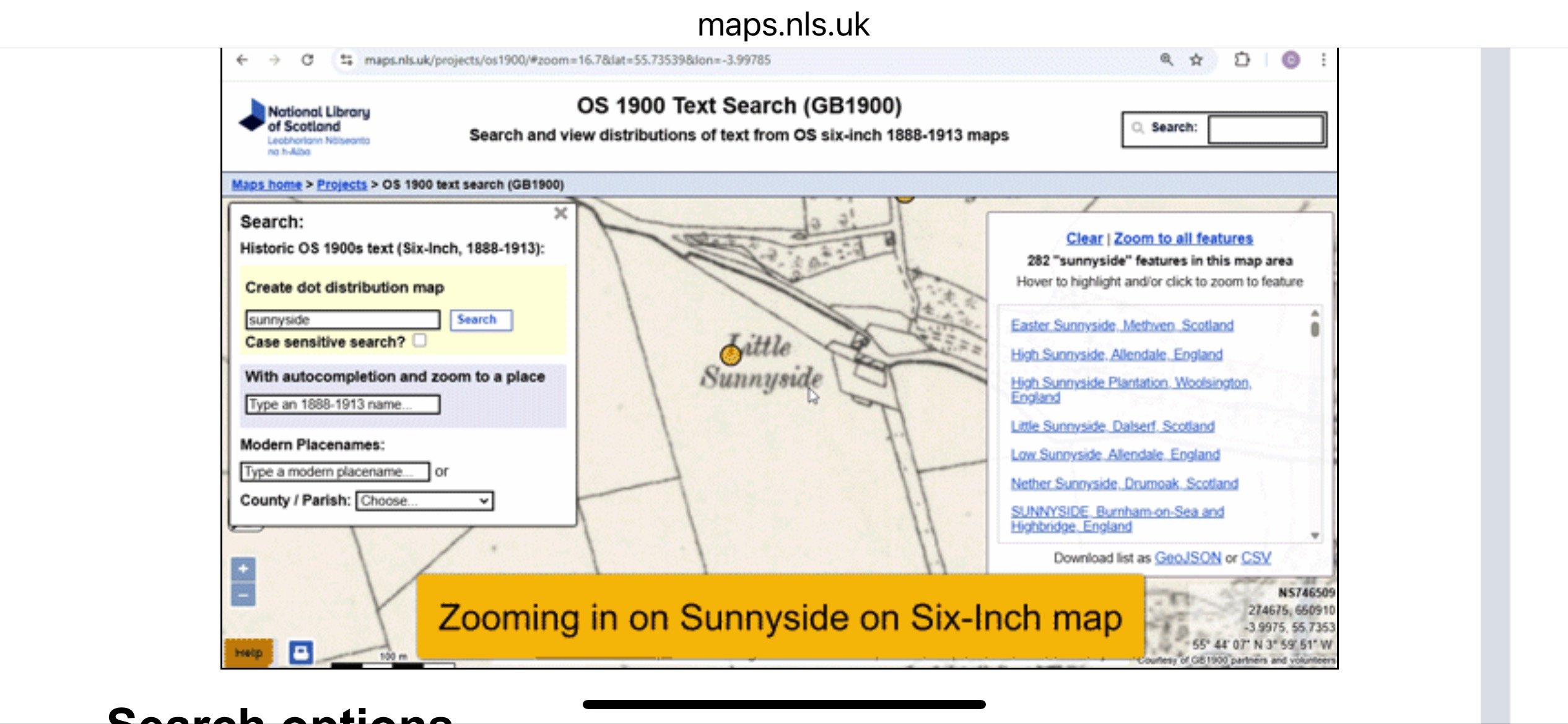
Search viewer: (https://maps.nls.uk/projects/os1900/ : viewed 5 April 2025).
How-to info: National Library of Scotland, “Help - OS 1900 text search (GB1900 gazetteer) and dot distribution maps“ (https://maps.nls.uk/projects/os1900/help/ : viewed 5 Apr 2025).
Happy family tree climbing!
Myrt 🤗
DearMYRTLE,
Your (not so) retired friend in genealogy.
Hey, @DearMYRTLE, that brings to mind a wonderful podcast interview that @Emma - Journeys into Genealogy podcast did with Chris Fleet of the National Library of Scotland in 2021 (https://podcasts.apple.com/us/podcast/maps-the-ordnance-survey-digitisation-and-more/id1541830347?i=1000566383953).
She also shared a wonderful article for our 2024 Projectkin Members' Corner series illustrating how the side-by-side feature of the library helped her find an ancestors' home in London. (https://projectkin.substack.com/p/mystery-where-is-albert-place-london)...
Swoon... maps. Emma also introduced me to the @Londonist here on Substack. He has a fabulous series on historical map, not to mention the strolls through London today. (https://londonist.substack.com/t/historical-maps)
Thanks Myrt! I’m just starting my research there, this will help a bunch!